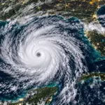

The storm has reached Category 1 strength and could intensify further before reaching the U.S. coast. Northern and northwestern Florida are among the areas facing threats from strong winds, heavy rainfall, and flooding.
Hurricane Isaias strengthened on Thursday, October 8, 2026, as it moved across the Gulf of Mexico toward the southern coast of the United States. The National Hurricane Center (NHC) issued alerts for parts of Florida, Alabama, Mississippi, and Louisiana due to the threat of damaging winds, heavy rainfall, and dangerous storm surge.
According to the 5 a.m. advisory, Orlando time, the hurricane had maximum sustained winds of approximately 80 mph (130 km/h), with even stronger gusts. The storm was located about 420 miles (680 kilometers) south-southwest of the mouth of the Mississippi River, moving east-northeast at approximately 9 mph (15 km/h).
Where is Hurricane Isaias, and when could it reach the United States?
Isaias is currently over the Gulf of Mexico, northwest of Mexico’s Yucatán Peninsula. The storm has reached Category 1 strength on the Saffir-Simpson Hurricane Wind Scale.
The NHC forecast indicates that the system is expected to gradually change direction, moving northeast before turning north. Landfall along the U.S. coast is expected late Friday, October 9, or early Saturday, October 10.
Forecasters expect the hurricane to continue strengthening through early Friday.
Which parts of Florida could be affected?
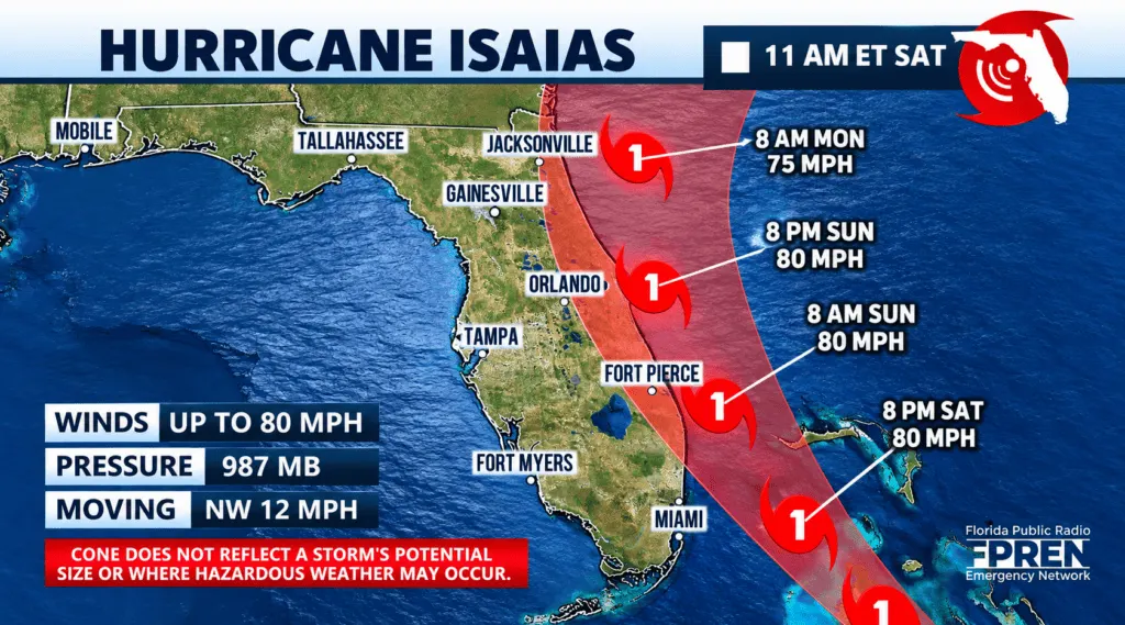
The greatest concern is focused on the Florida Panhandle, the northwestern part of the state near Alabama and Georgia.
According to the reported official alerts, a hurricane warning is in effect from the Bay-Gulf County line in Florida westward to Ocean Springs, Mississippi. In Florida, this includes coastal areas near Panama City, Pensacola, and Destin.
A tropical storm warning extends from the Bay-Gulf County line eastward to the Aucilla River.
A storm surge warning, indicating the risk of life-threatening coastal flooding, extends to the Steinhatchee River. A storm surge watch is also in effect farther south, reaching Yankeetown along Florida’s west coast.
Which U.S. states are in Hurricane Isaias’ path?
Coastal alerts have been issued for Louisiana, Mississippi, Alabama, and Florida. However, the storm’s effects could extend well beyond coastal communities.
The forecast also indicates the possibility of heavy rainfall across parts of Georgia, Tennessee, North Carolina, and South Carolina over the weekend.
This does not necessarily mean the hurricane’s center will pass directly over all these states. However, its circulation could produce hazardous weather conditions even in areas far from landfall.
Heavy rainfall and flooding risks
From Friday through the weekend, Hurricane Isaias could bring rainfall totals ranging from 3 to 7 inches (75 to 180 millimeters) across portions of the central Gulf Coast, from southeastern Louisiana to the Florida Panhandle.
Some isolated locations could receive as much as 10 inches (250 millimeters) of rain.
The NHC also warns of possible urban flooding, flash floods, and overflowing rivers.
In addition to heavy rainfall, isolated tornadoes could develop Friday night across coastal Alabama and northwestern Florida.
The tornado threat could continue Saturday, potentially extending into eastern Alabama and western Georgia.
Will Orlando and Central Florida be affected?
As of Thursday’s referenced advisory, Orlando was not included in the coastal areas under a hurricane warning. The greatest threat remained concentrated across northern and northwestern Florida.
However, that does not rule out the possibility of rainfall or wind gusts across Central Florida.
At this point, significant impacts in Orlando, Kissimmee, Davenport, and surrounding communities cannot be confirmed without reviewing the latest local weather advisories.
The Tampa Bay area and Florida’s west coast should also continue monitoring the storm’s development, particularly because of storm surge alerts affecting coastal communities farther north.
Authorities urge residents to complete hurricane preparations
The National Hurricane Center urged residents in areas under hurricane warnings to complete preparations to protect lives and property on Thursday.
The main threats include damaging winds, falling trees, power outages, structural damage, and seawater flooding coastal neighborhoods.
The NHC also warns of dangerous surf and rip currents along the Gulf Coast.
Weather conditions could deteriorate before the hurricane’s center reaches land.
Sources: National Hurricane Center (NHC), National Oceanic and Atmospheric Administration (NOAA), and National Weather Service (NWS). Information attributed to the 5 a.m. ET advisory on October 8, 2026.